
USA BICYCLE TOUR, SUMMER 1995
by Michael Krabach
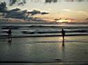
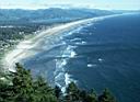
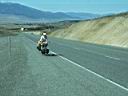
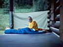
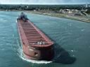
This bicycle tour crossed the United States using the Adventure Cycling mapped route for the central USA. Amtrak was taken from Providence, Rhode Island to Seattle, Washington. After crossing to Bremerton Island, the route went west under the Olympic Peninsula to the Pacific coast. Traveling down the coast to the middle or Oregon, I turned east at Florence toward Eugene. I stayed on the regular TransAmerica Central bike route until the Mississippi River. There instead of heading east via the normal route, I headed northeast thru Illinois and Indiana to Michigan for a short stay in Port Huron. From there I biked across the lower part of Ontario, Canada, crossing back into the US at Buffalo, New York. Two more days and I connected with the Adventure Cycling TransAmerica Northern bike route. Then on to the end of the route at Bar Harbor, Maine. From there I biked down the Atlantic coast to home in Rhode Island. The trip covered 5992 miles, took 3 ½ months. Average cost for food was $7.13 per day and camping averaged to $1.92 per day. Average mileage was 58.5 miles per day, and my average speed was 10.4 mph. See the [Statistics Table] for details.
View Using the Thumbnail Photos *
View large size photos using the Thumbnail Photos * (new format)
Start Viewing with the Route Map **
Start Viewing with the 1st Detail Map **
Start Viewing with the 1st Photo **
*Click on the index (thumbnails) photos to view the respective photo in larger size. There are no text captions when viewing the photos this way. The photos are about 40k each. Back arrow to return to the thumbnail screen.
** Click on the shaded areas to see more detailed maps. NOTE: The maps are very large, from 100k to 200k, and will take some time to download if you use a dial up connection. Be patient, if your browser cache is large enough, you may not have to reload the maps everytime. Click the red dots to see the respective photos with text captions. You may go back to the map with the [map] link or you may proceed directly to the next photo with the [next] link. When on the detail maps you may move between maps by clicking invisible links (cursor will change to finger) toward the edge of the maps. Either end of the marked route is linked to the next detail map, so you can move along the route without referring to the Route Index Map. The adjacent sides of the all maps are linked to to the next map in that direction. If there is no detail map in that direction the link will be back to the the Route Index Map. If this is confusing just click the edge of the map in the direction you want to go.